


Silerton Voting District, Hardeman County, Tennessee
About
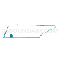
Outline

Summary
| Unique Area Identifier | 668766 |
| Name | Silerton Voting District |
| County | Hardeman County |
| State | Tennessee |
| Area (square miles) | 56.42 |
| Land Area (square miles) | 56.21 |
| Water Area (square miles) | 0.21 |
| % of Land Area | 99.63 |
| % of Water Area | 0.37 |
| Latitude of the Internal Point | 35.34625250 |
| Longtitude of the Internal Point | -88.86597130 |
Maps


Graphs
Select a template below for downloading or customizing gragh for Silerton Voting District, Hardeman County, Tennessee


Neighbors
Neighoring Voting District (by Name) Neighboring Voting District on the Map
- 3-2 Montezuma Voting District, Chester County, TN
- 3-4 Masseyville Voting District, Chester County, TN
- 3-6 Deanburg Voting District, Chester County, TN
- 6-5 Medon City Hall Voting District, Madison County, TN
- Bolivar Voting District, Hardeman County, TN
- Campbell Chapel Voting District, Hardeman County, TN
- Hornsby Voting District, Hardeman County, TN
- Toone Voting District, Hardeman County, TN
- West Bolivar Voting District, Hardeman County, TN
Top 10 Neighboring County Subdivision (by Population) Neighboring County Subdivision on the Map
- District 6, Madison County, TN (10,757)
- District 1, Hardeman County, TN (4,827)
- District 7, Hardeman County, TN (3,313)
- District 2, Hardeman County, TN (3,262)
- District 3, Chester County, TN (2,739)
- District 8, Hardeman County, TN (1,780)
Top 10 Neighboring Place (by Population) Neighboring Place on the Map
Top 10 Neighboring Unified School District (by Population) Neighboring Unified School District on the Map
- Jackson-Madison Consolidated School District, TN (98,294)
- Hardeman County School District, TN (27,253)
- Chester County School District, TN (17,131)
Top 10 Neighboring State Legislative District Lower Chamber (by Population) Neighboring State Legislative District Lower Chamber on the Map
- State House District 94, TN (70,412)
- State House District 72, TN (63,136)
- State House District 73, TN (60,027)
- State House District 80, TN (54,808)
Top 10 Neighboring State Legislative District Upper Chamber (by Population) Neighboring State Legislative District Upper Chamber on the Map
Top 10 Neighboring 111th Congressional District (by Population) Neighboring 111th Congressional District on the Map
Top 10 Neighboring Census Tract (by Population) Neighboring Census Tract on the Map
- Census Tract 9504, Hardeman County, TN (5,781)
- Census Tract 9703, Chester County, TN (5,779)
- Census Tract 9501, Hardeman County, TN (3,959)
- Census Tract 9503, Hardeman County, TN (3,798)
- Census Tract 18, Madison County, TN (3,241)